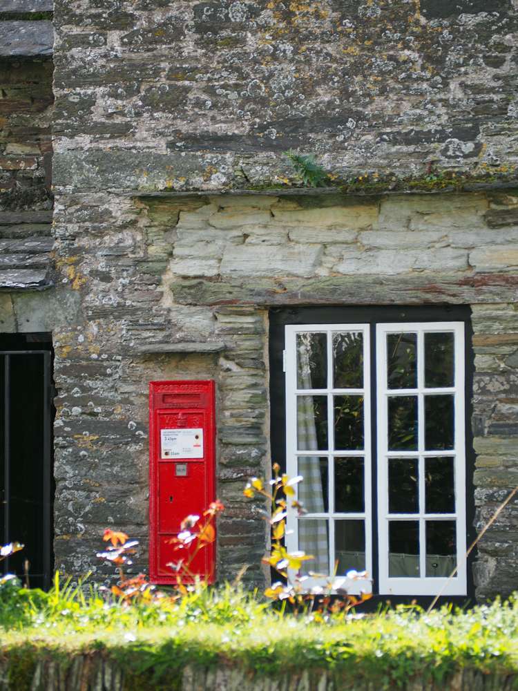
Tintagel in north Cornwall is a little village with a big story, it has long been associated with King Arthur. One of the first buildings you come across as you walk down the main street, is the Old Post Office. Dating from the 14th century,this grade 1 listed former manor house became a post office in the 19th century. It’s now looked after by the National trust. I was trying to avoid people, so it’s hard to see the wavy shape of the roof.
 The village is one of the most visited places in Cornwall and hence has many touristy souvenir shops.
A late start and an attempt at stopping in Boscastle, unsuccessful because of a lack of parking places, had led to empty tummies, but we managed to resist the lure of fudge! Instead we found the King Arthur’s Arms,
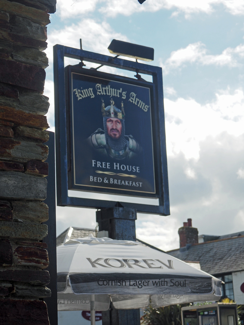
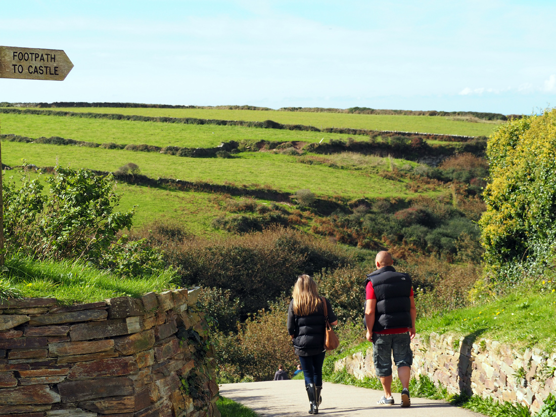
and had a tasty pub lunch. It was wonderful to be able to sit outside, in full sun even though it was October. All fuelled up we walked down the village, perhaps a hundred yards in the direction of the sea, and took a left turning from the road. This is the lane that leads to the coast path and the castle.
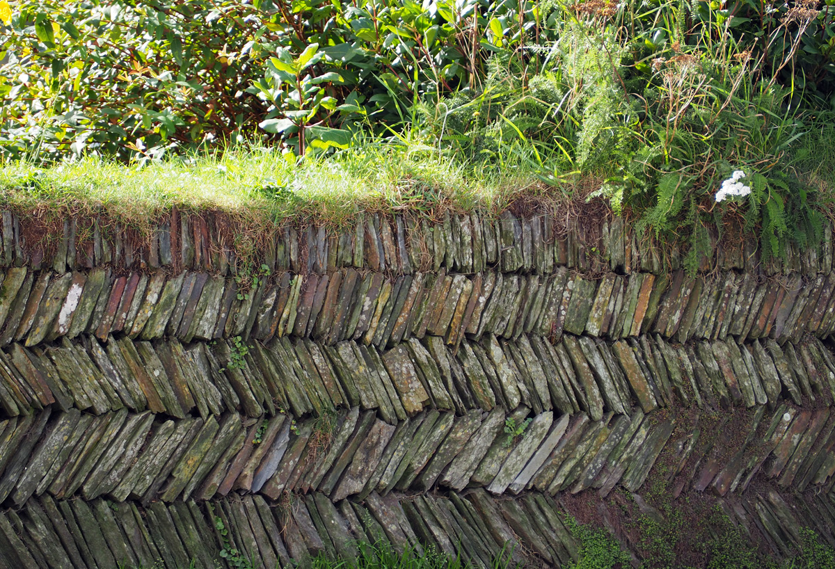
 We passed this beautiful example of a Cornish dry stone wall.
 This old gate post shouted out ‘please photograph me’, knowing I’m not the only one who would like it, I thought it was my duty.
 The track continued down towards the sea, but we took the footpath leading to the cliffs.
 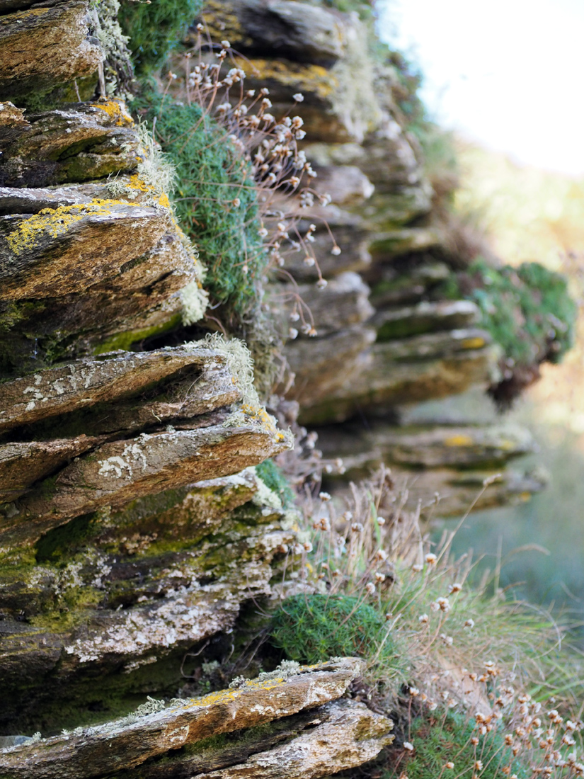 It’s too late for the Thrift this year, the pink flowers will be back next spring, meanwhile the lichens and mosses cling on.
 Looking down from the footpath, our first glimpse of the turquoise sea. It could be a Mediterranean island.
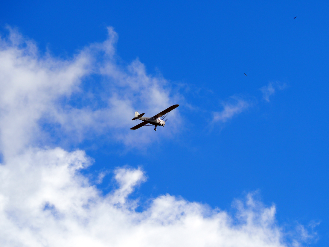
 And above, a different shade of blue, and what a fantastic view the pilot of this plane had!
 I’m happy to settle for this view, of the amazing craggy rock stacks.
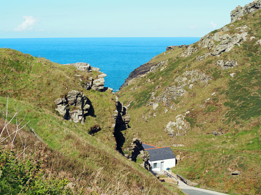
 Across in the distance was the way to the castle, an English Heritage site. If we were earlier we might have had time to justify the entry cost of £8 each, but for an afternoon stroll we preferred the peace of the hill.
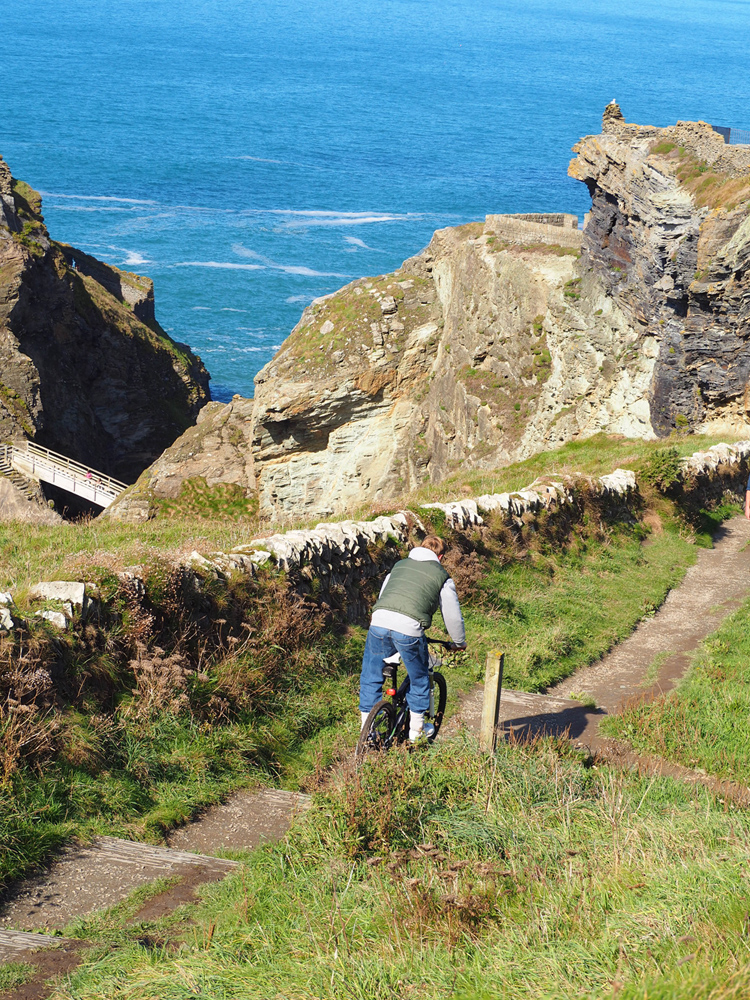
 So up we went, and then he came down, crazy guy, I wouldn’t have had a hope of staying on a bike on that track.

Through the narrow gap at the top of the path, the view opens up of the footbridge leading to the castle.

 I don’t think that footbridge would be everyone’s up of tea, do you?
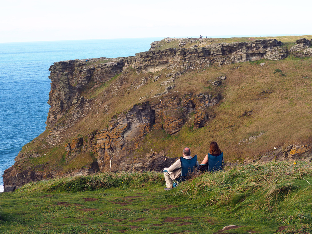
We’ve made it up the hill though, and so have they, how clever bringing their own seats.
 A few well places benches up here would be wonderful.
 Never mind we’ll walk on. It isn’t very far along the top and should you prefer driving there’s a car park at Glebe cliff, that I think is National Trust. From there you could walk east towards the castle, and enjoy the views while avoiding any climbs.

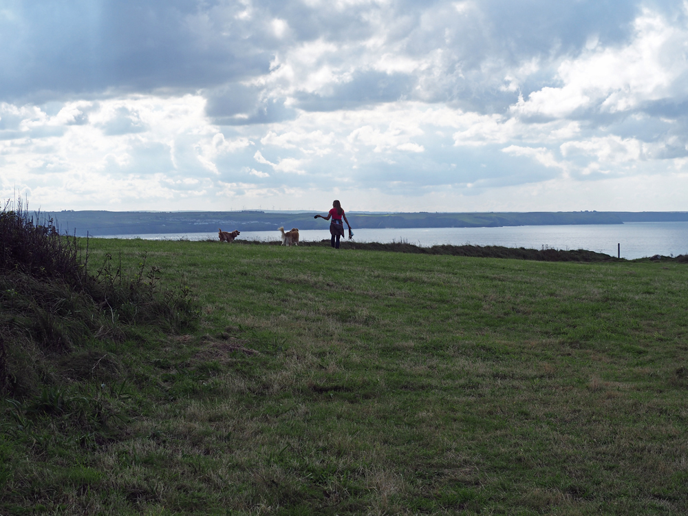
It’s a great place for dog walking, Dido and Daisy were happy.

We left the sea behind to look in the church, and there were more stone walls.
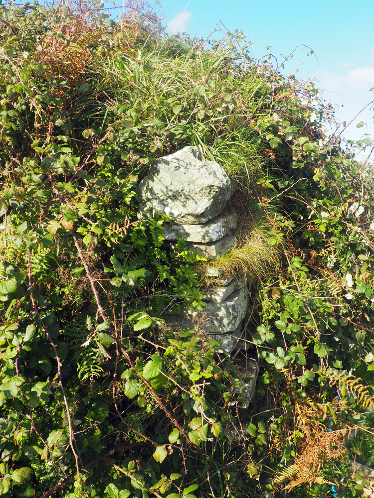
Another old gate post
 And then a lane leading back to the village.
 A last look at the Old Post Office – for now!
 I’m sharing this walk with Jo, visit her Monday Walks to see where her other friends have been this week. Mine is a mere two miles, but worth it if you’re in the area and you can always walk the whole of 630 miles of the South West Coast Path while you’re here.


 where Vigilant is still being refurbished. There’s always plenty to see close to water and Topsham is no exception.


 The evening is the best time to be on the quay. Look up river,
 or down towards Exmouth.
 If you’re there for the day, then outside the photo to the left is the Quay Antiques centre which will keep you happy for hours while you hunt for treasure.
 to the glorious view of the estuary, with Exmouth to the east,and and Powderham and Starcross to the west.
 As the light changed, we sat for ages listening to the varied calls of the curlews.
 Then our tummies began their own howl, so back we went, meandering slowly,
 envying the owners of these two gardens,
 Wouldn’t they be lovely places for to sit and write or just sit? We sat in the George and Dragon eating pizza!
 No such luck.
 This is the view up river.
 And this is down. I can’t make any sense of it, but the work’s been going on for several years already. Retracing my steps I pause to admire what I call the photo posts ( they make a great setting for family photos).
 Then it’s back to the path.
 Where I find this Hairy Dragonfly lady, quite happy to pose for me.
 The flora and fauna get together, and give each other a helping hand.
 Now, I hope that someone can tell me what this wildflower is, Jude perhaps? I only saw one.
 Flora and George are keen to get going now, it’s such a hot day, they’re tempted by the water.
 As it’s shallow they give it a try.
 But not for long.
 Next we cross the wooden footbridge.
 This is the point where the North Brook joins the leat, just before it re-joins the river.
 The dogs know there’s rabbits around, but they have no hope of catching them.
 The bright green plant intrigued me, it’s further away than it looks, could it be a Gunnera escaped from a garden?
 We’re getting close to Mill Road now, the Mill was an overgrown ruin when I was a child. A grade 2 listed building, it belongs to the city council, and quite a lot of restoration has taken place. The first mill was built in 1284 by Countess Isabela. It was powered by the leat and was used to grind corn, but from the 1630’s paper making using rags began. Through the 18th and early 19th century, the quality of paper produced changed to good writing paper, notes for private banks and news print for the Times of India. In 1816 a fire destroyed the old mil and this replacement was built.
 At it’s height, 200 people were employed, the Industrial revolution was here and it was one of the first to install machines.
 Once rag paper was replaced with wood pulp, the mill went into decline, such a shame. I’ve always been interested in the building, it’s so striking.


 Across the water the still bare trees created some nice reflections. George jumped in because he saw a duck, his first time in water other than the sea or a bath, Flora gave him a good telling off.


 There a few very colourful minutes when a barge came along.
 Complete with quivering reflections.
 The hedgerow provided lots of interest

 In the distance stands the tower of Halberton church. This part of the walk forms an elbow shape, and I hadn’t realised how close we are to the village when we set off.

 They were both fine and very hungry when we got home and then slept very well.


 So we turned tail towards the direction of the river, passing elegant gates leading to secluded mansions.


 If you start walking by the lifeboat station on Marine Drive, then up the cliff to the needle, it’s less than a mile and a half. If you keep going you reach Sandy Bay, with it’s caravan park in another mile. So this walk could take less that an hour, if only there weren’t such wonderful distracting views!
 stopping to see the Lower Ferry,
 and enjoy the view to Kingswear, via a very pretty garden, then on along the waterfront.
 But we were hot and in need of ice cream, not dungeons! No photos I’m afraid, but mine was toffee fudge. We retraced our steps to summon the little ferry, turning the board around so that the ferryman could see he had passengers from the other side of the river.I rarely go on a boat, so it’s always a delight to see the view from one.
 Lot’s of interesting and very expensive properties on both sides.
 and there’s Bayard’s Cove Fort again.
 Nearly back to town. Just ten minutes or so on the water, and it feels like a different world.
 They’re still crabbing, I’d be a bit nervous if my child was sitting there. We’ve missed lunch, so we stroll towards the little harbour to see what we can find. No lunch, just a pasty and some new sunglasses for me!


 I’m usually driving some impossibly narrow lane when I see a tractor working, so this was a real treat for me, I even got a wave from what looked like father and young son.


 For those of you who like a bit of decay, last years beauty hasn’t quite faded away.


 We’ve only walked a couple of miles, but with eyes wide open and camera ready, so it took nearly two hours.
 The dogs can remember this as a mud wallow and were a bit put out, but no worries we’d brought plenty of water for them!
 A fairy tale cottage, painted in regulation Killerton colour, what a lovely place to live.
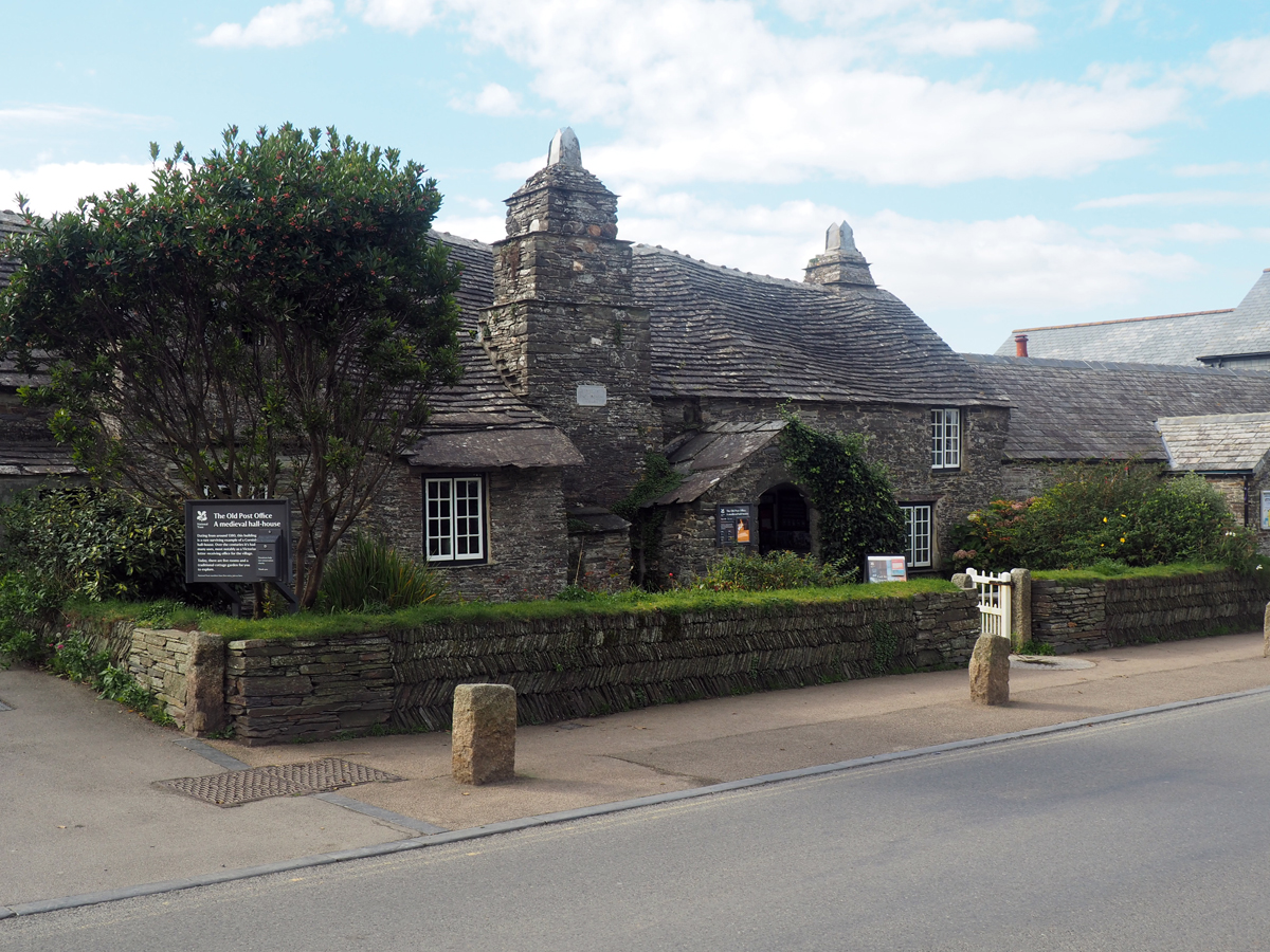


 This is part of the old city wall.
 But it feels like I’m walking in the woods.
 One of the old gates, walking on past there are places to peep through.
 Dido and Daisy prefer the shade and would like to run off into the trees, I like the sun on my face.

 Ahh more steps!
 But the view makes it worth it.
 This is the entrance I was looking for. The path through Athelstan’s tower leads to Rougemont garden where you can walk inside the wall.


 A last little bit of treasure.

